
Two weeks ago we woke up to a gloriously sunny day, and with just a few weeks left in New Zealand we decided it was too good to waste. We've been living just 45k from Glenorchy all winter and had never made the drive out, so we decided to hop in the car and have an adventure. Glenorchy is a little one horse town, with just a gas station, a general store and a few cafés, but it has some amazing scenery and was the setting for quite a few scenes in the Lord of the Rings. We had brunch at the Glenorchy Café and enjoyed pancakes and pulled pork sandwiches in their back garden in the sunshine and then took a walk down to the lake shore. From the lake we noticed what looked like a trail up one of the smaller mountains in the middle of the valley, so we stopped in the store to ask about it and found out it was a fairly straightforward hike.

After a short drive out of town we parked the car at the trail head, slathered on some sunscreen and headed into the trees. The first two-thirds of the trail was steep switch-backs through the forest that reminded us a lot of hiking in Alaska. The trail was well marked with orange blazes, despite the fact that steep terrain and heavy brush made it pretty much impossible to step off the trail even if you wanted to. Once we reached the tree line, however, the trail markers completely disappeared and the final one-third of the climb was an extremely steep scramble through the tussocks and spear grass and over loose rock. After an hour of clinging to clumps of grass to try and stay on the unstable and near-vertical mountainside we crested the ridgeline and realized we had missed the trail and had been following a goat track instead.

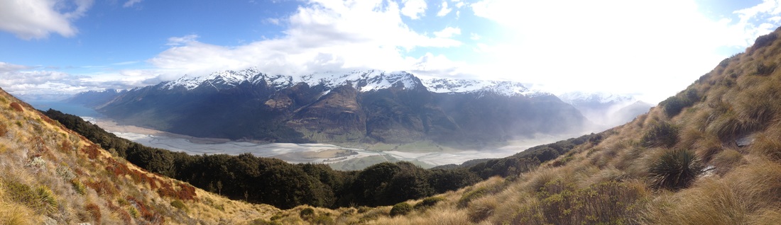
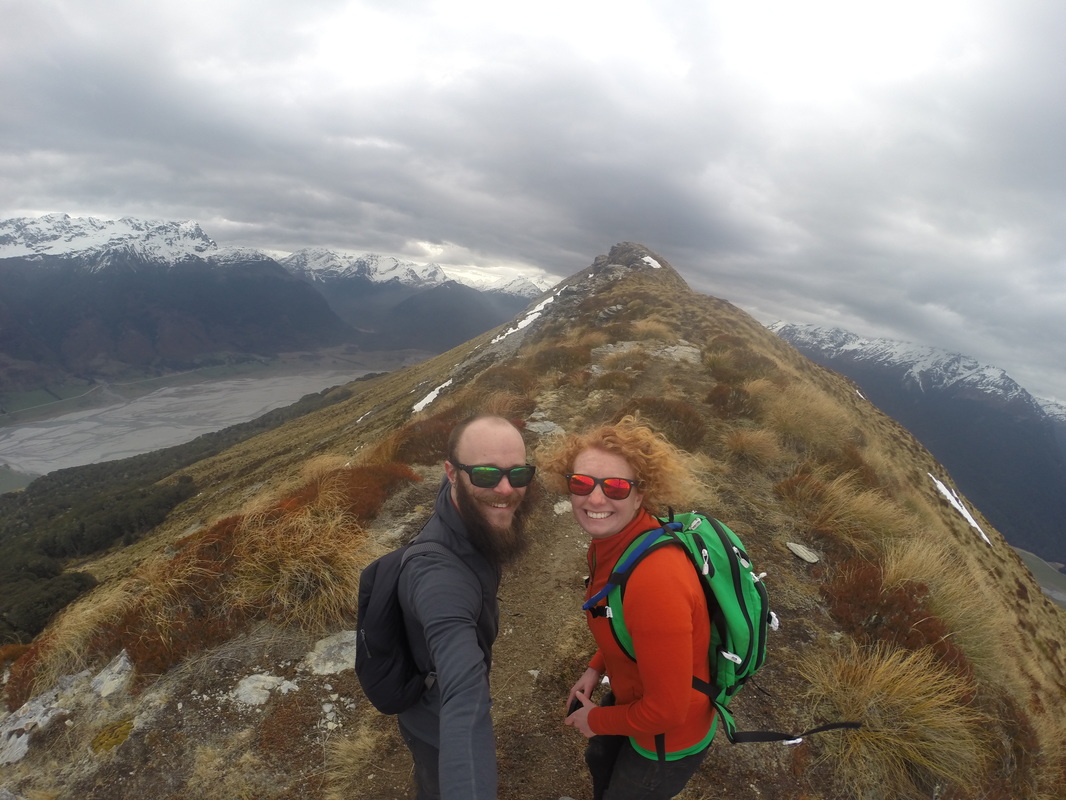
Once we were on the established trail the going was much easier and we made it to the summit just as the weather started to take a turn for the worse. The wind picked up and dark clouds started rolling in, so after 4 hours of climbing we only spent about two minutes on the summit before making a beeline for the treeline. The views from the summit were well worth the effort though, from 1,375 meters we had a full panoramic view of the Dart and Rees river valleys and Lake Wakatipu. The hike down had its own challenges and even on the right trail the terrain was very steep and we were constantly setting off little rockslides. Still we made much better progress on the way down, and reached the trees in about a quarter of the time it took us on the way up. The rest of the descent took about 2 hours and we reached the car just as the first serious raindrops started to fall. Our timing with the weather couldn't have been more perfect!
You can see more pictures from this beautiful hike here.
You can see more pictures from this beautiful hike here.
 RSS Feed